Beyond the Pelton Lane road bridge at the west end of the junction was the vast array of sidings at Stella Gill where coal trains would be marshalled for journeys up the line to Consett (trains for Consett would reverse out of the sidings over South Pelaw Junction and then move forwards up the incline to Consett) and to the rest of rail network.

As well as the junction, the sidings connected to a series of inclines (the two closest to Stella Gill being Waldridge Incline, which ran next to William Street in Pelton and Eden Incline part of which, including Pelton Level shed, is now Roseberry Grange golf course near Grange Villa) that brought coal from the local collieries as far away as Waldridge near Chester-le-Street.
With the closure of the local collieries, the sidings lost their reason for being and, by 1970, had been lifted with the exception of just a single track (previously No 3 Incoming Road) remaining and all of buildings, with the exception of the NCB shed and the bridge, which carried a footpath and a gas main, demolished.
Stella Gill can be found on Google Maps here: 54°51’48.4″N 1°35’39.6″W – Google Maps


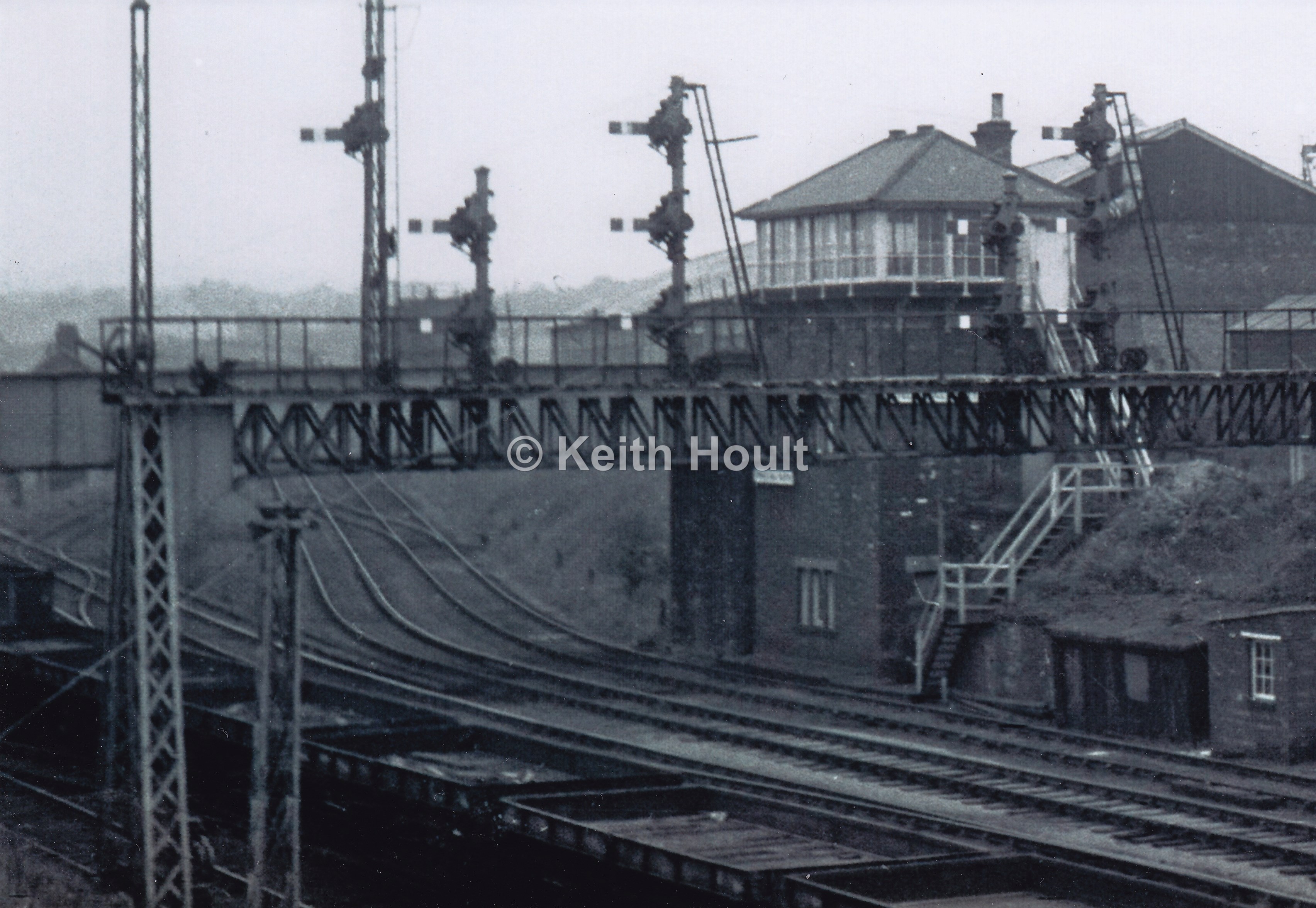
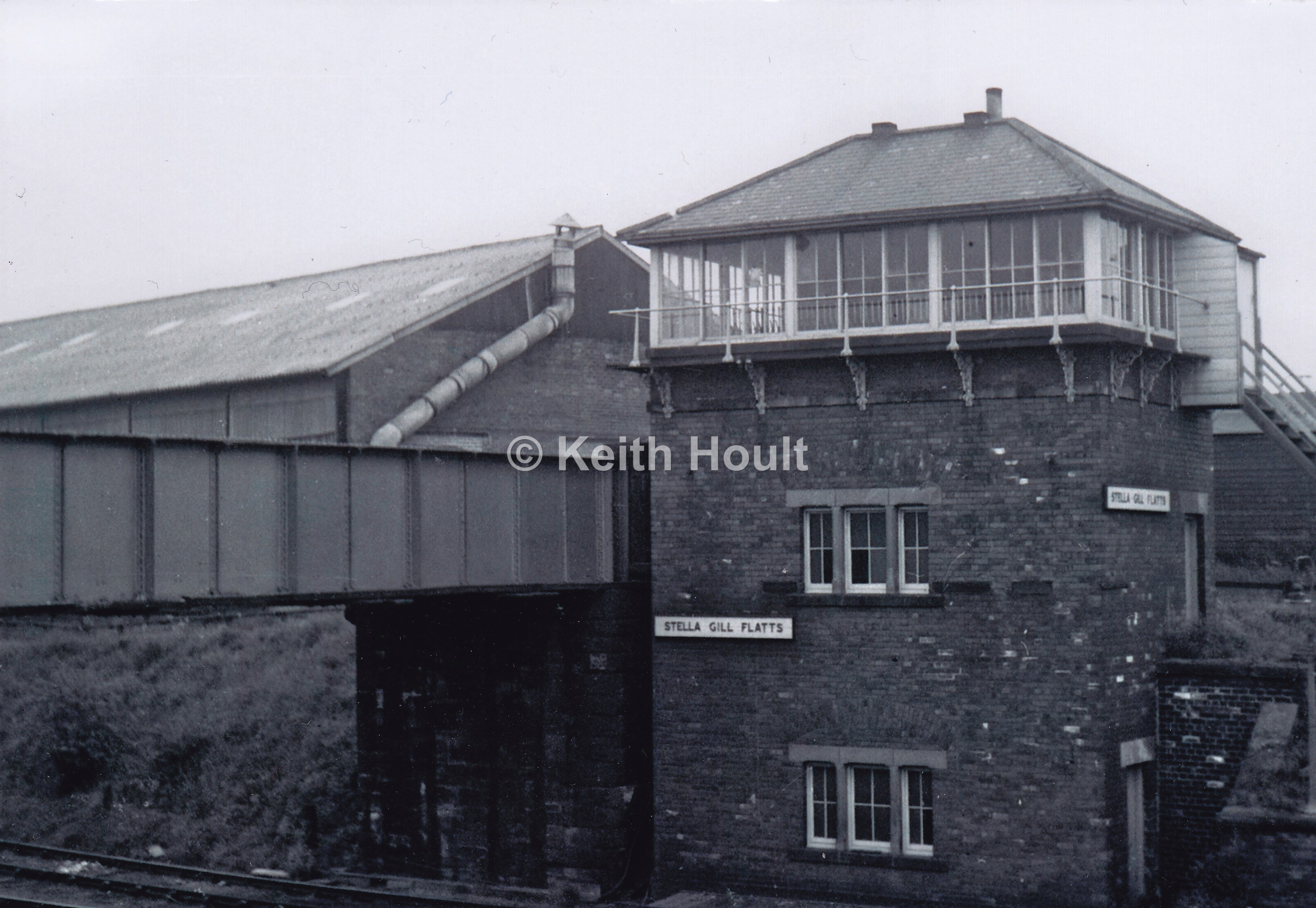
The complex of sidings, of which there were 36, were controlled by Stella Gill Flatts Signal Box, close up photographs of which are few and far between but, courtesy of Keith Hoult, here are a few images:


Stella Gill in the 1960s…


The photo below clearly shows the lines from South Pelaw Junction in to the Stella Gill sidings complex. The lines were named and numbered from left to right as follows:
- No.3 Incoming
- No. 3 Outgoing
- No. 2 Outgoing
- No. 1 Outgoing
- No. 2 Incoming
- No. 1 Incoming

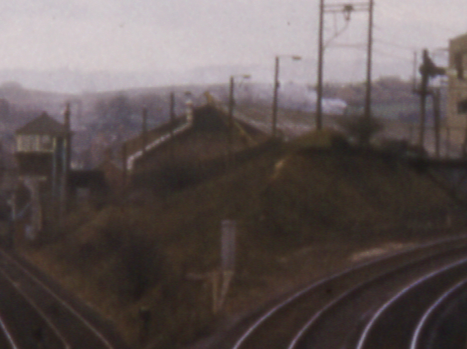
Stella Gill in the 1970s…

Stella Gill in the 1980s…

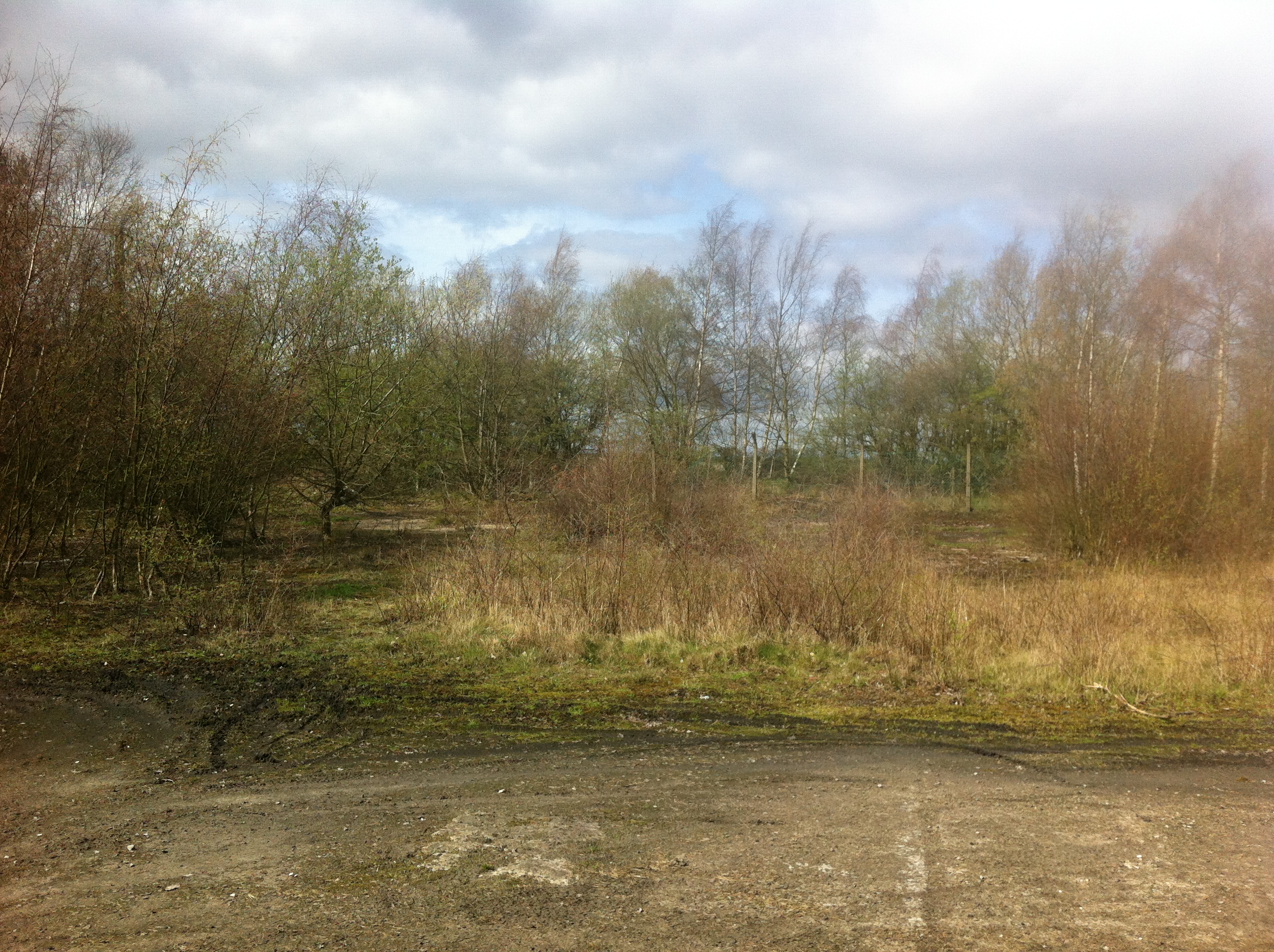
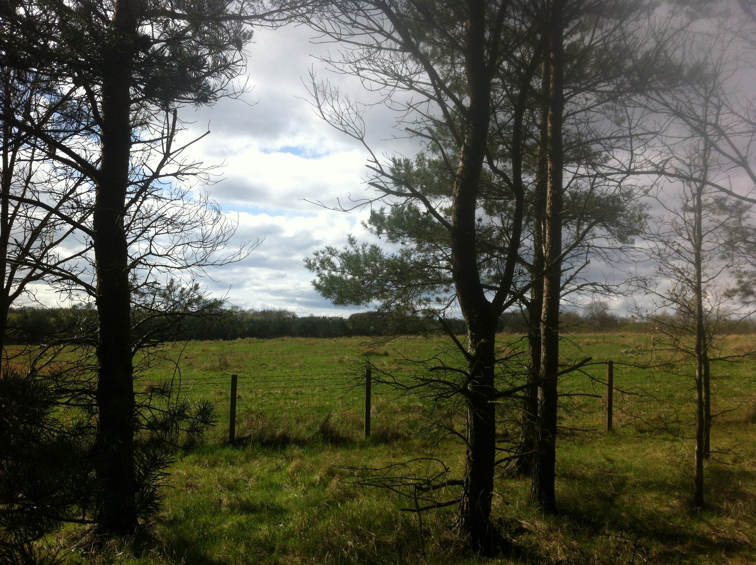
The Site Today…

As I mentioned earlier, the whole site has changed substantially and nothing demonstrates this better than the 2009 Google Earth image to the right.
The NCB shed is clearly visible at bottom left at the East End Bridge at South Pelaw Junction at the top right showing that area where the sidings were is now completely covered in trees which are a major challenge to try and navigate through in search of remains!
The route of the Consett line can be seen curving away to the top right and the lines towards other local collieries are visible towards the bottom left and clearly visible is the large residential development that has taken place in the area since the closure of the local collieries in the late 1960s.
Today, the whole ‘valley’ that the tracks ran in has been filled in such that the bridge next to the signal box is now at ground level and, due to the growth of vegetation it is all but impossible to take pictures from the same positions today as evidenced from the photo above…

There is no trace at all of the signal box and only the large NCB building in the background remains, some pictures of which, in it’s current state, can be seen further down this page.
Besides the bridge which is still used as a footpath today, the NCB shed whilst, for the most part, derelict, is still used (as of December 2013) for storage purposes by at least one local fertilizer business. The only other visible remains are some of the fence posts that can be seen in the last photo of the signal box above.
As mentioned earlier, the land under the bridge that spanned the sidings was filled in and the bridge, whilst still carrying a footpath no longer spans anything and remains, as I understand it, only because it supports a gas main which can be seen in the photos below.


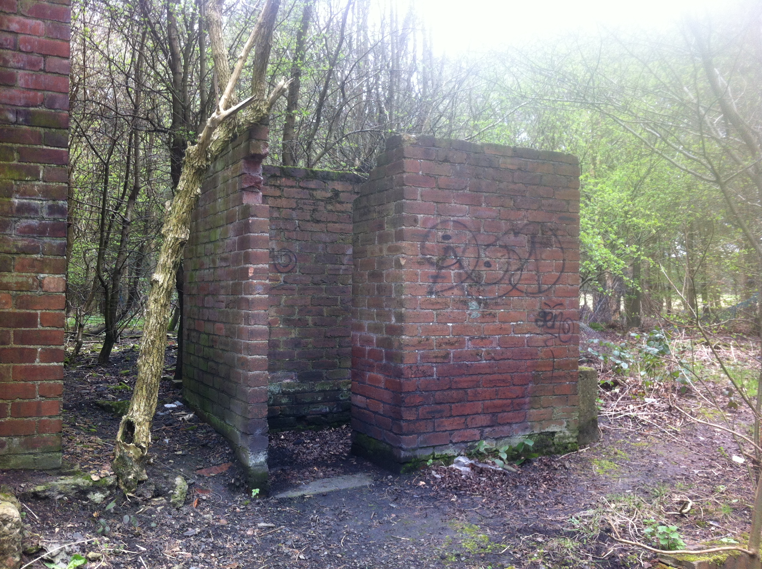
The ‘NCB Shed’…
Prominent in the photos of the signal box above but equally visible in all photographs of Stella Gill looking from South Pelaw is the NCB shed, one of the largest buildings on the route, the end of which is visible in the photo to the right taken in 1966.
One of the few buildings on the route that remain, the pictures below show the NCB shed as it was on 30th November 2013 and 9th April 2014.
It is, as you would expect, derelict and has attracted the attention of the local vandals and graffiti artists.


Alongside the shed was the ‘valley’ that the Stella Gill sidings ran through. This has been filled in and now looks like this:

In the third photo of the signal box, at the top of the page, there is a fence running from the left centre, the posts of which are still standing today:

This is the site of the large building in the background of that same photo, part of Stella Gill Coke works.
Remaining Trackwork
Not much to look at but there is track still remaining at the site as shown in the photo below:

The inset track, which is between the NCB shed and the line to Consett could be the last piece of track still in-situ between South Pelaw and Consett and is the middle of the three tracks behind the shed shown on the map section below:

December 2014
As of December 2014, British Gas are digging up the area around the NCB shed which has uncovered some railway related pieces including the concrete sleepers in the following photographs:


November 2021
More vandalism on the site has enabled some views on the interior of the building without actually having to go inside. Four shots taken on 25 November 2021


WOW!
Thank you so much for putting this site together, my daughter and I live in the houses near what was once Stella Gill Flats and have become very interested in the history of the site!
Not least I wanted to de-mistify what is now a creepy looking derelict NCB building so that my daughter doesn’t worry about it – the school rumour mill has the old shed used for lots of gory things haha.
Its great and tinged with sadness to read about what used to be here before our house, once again thank you – your work is important and appreciated
Regards
Chris
Thank you for the comments Chris, part of the building was still in use until very recently by someone who stored fertiliser in there…
John
Nice one Chris. I walk and cycle pass this route regularly. As you rightly point out the line at the back of the shed was the Consett line. However the line that went under the bridge was originally the Stanhope to Tyne railway opened in 1834 which became the Pontop to South Shields. Are you aware of any books that have been written on Stella Gill. I have never come across anything that describes what would have been a very busy and thriving marshalling yard back in its hey day,
I’m not aware of any books specifically about Stella Gill but I’ve got a list of books and magazine articles that cover the line here: http://southpelawjunction.co.uk/wp/?page_id=20
John
I did not expect to find a site that would explain for me the enigma of a major rail bridge at ground level.
I enjoyed unravelling the layout.
What was the purpose of the concrete road that leads from the inner end of the bridge toward Chester le Street ,that is several hundred metres long and in good condition ?
Love reading through your site, used to live in Pelton Fell up until 2008. Explored that sight a lot during the time. There is also another length of track still in place next to the shed, isn’t inset in the ground, just over grown.
If you have a good look in the undergrowth towards the end of the shed where the shuts are installed you’ll see it. Seems to be a base for a water tower there as well. Guessing it is part of the section which ran right next to the shed. Will need to have a look back up one day.
Looks like the NCB shed will be gone soon. The land is up for sale
Many thanks for your superb site. I have finally solved the mystery of an old J. W. Armstrong photo sold to me as Flatts Lane, Teesside, which it obviously was not. The info I now have is totally comprehensive and first class.
I hope John Donnelly maybe able to explain the reason for the concrete roadway nr the NCB shed.
I have found a few artifacts hidden within the undergrowth like 2x sets of buffer beam stops a few feet west of pelton rd bridge, a sign in the trees warning of overhead power lines. Wooden an concrete sleepers, concrete fence posts, a siding at the site of pelton station
Rob – the concrete sleepers are left over from when the main line was lifted after closure. In the 1970s the up main was relaid with concrete sleepers which can be seen in this photo on Flickr: https://flic.kr/p/2j6mh9y
I’ve not noticed the overhead warning sign, there was one at Beamish station but I ‘recovered’ it and have it at home. Your comment re the siding at Pelton station is interesting, I certainly didn’t know about that…
The old NCB building is now refurbished & a storage site for a few companies
Where are these?
Have a look at the ‘then and now’ page here: https://southpelawjunction.co.uk/wp/?page_id=2 which shows where some of them are. With regards to the siding at Pelton Station, it is what was the old head shunt for the goods yard. If you go towards King Coal from Pelton, the land rises up and, just before you get to Kind Coal, there are some sleepers still in situ.
It seems the NCB building is being demolished.
The NCB shed is now being refurbished by the looks of things today
I worked on the demolition for level group from Wingate in mid 60s and remember the large concrete coke ovens and large chimney stack those were the days
Fascinating stuff, I grew up in the North Lodge area of Chester-le-Street and my friends and I used to play on the pit heap near Stella Gill. There used to be an old railway signal on the top but it got chopped down during a miners’ strike, presumably to be used as fuel for someone’s fire.
I also remember the trains running along the embankment just behind our house en-route to Consett, we used to play on that too, the entire length of the track seemed to be covered in what we called iron ore (small round grey balls that were ideal ammunition for catapults).
i have a painting of 92060 pulling iron trucks up to consett with engine on back pictures 45 inch by36inch big signal box on dont know which one south pelaw maybe the painting was done in 1976 artirt ed kille worked at mars slough as did the person who commisioned it.he worked at mars as well .he also is the driver of the the engine looking out the engine aswell do you think there would be any interest in this painting in this painting hes not with us now or his partner was rosemarie dont think theres many still with us from them days my father worked on goods had a welsh driver who used to fly down from consett frighting my dad guard billy atkinson